Staircase and Allambee Beek Falls
 |
| Allambee Beek Falls |
Off track Hike 7km / 2-3 Hr / Return
Map:

Terrain/Rating:
Easy undulating walk along 4wd track then undefined off track walk down to first falls, along creek valley to 2nd falls then back up to 4wd track.
This hike has a mix of the usual otway bushland and lush fern rainforest along the river valley.
An Easy to Medium walk requiring some navigational and bushbashing skills.
Be wary that there is no defined track to the river so you will have no idea at times what you will be stepping into.
There may be snakes especially in summertime, so have an emergency plan in place.
There may be snakes especially in summertime, so have an emergency plan in place.
Mobile reception was patchy/poor down along the creek bed. A satellite phone would be sensible for lone hikers.
Start / Finish Time:
9:00am / 12:00pm
Start / Finish Location:
Intersection of Curtis Rd and Mt. Sabine Rd.
Trip Summary:
Curtis Rd I believe is a seasonally closed road and can also be a rutted muddy mess about 1km in.
If you start from the intersection/gate, you will need to walk for about 2km along Curtis Rd then divert right into the bush. There is no particularly distinct track through the forest. There are pink ribbons that mark a way through the forest, but you pretty much head down to the "river" at a random spot.
The walk I ended up doing resulted in a triangle, falls 1, scale the creek to falls 2, then back to the track.
How to get there:
From Lorne drive up Erskine Falls Rd to the end. Turn left along Mt Sabines Rd for 20 minutes until you get to Curtis Rd on the left, (sharp hairpin, easily missed). There are No toilets here.
Trip Detail:
This trip is to two of the lesser known falls in the Otway National Park. They are both off track so you should take a detailed topo map and have some navigation skills be it by either compass or GPS to find the falls.
As mentioned Curtis Rd can be unsuitable for a non-4WD, so I started this walk near the intersection with Mt Sabine Rd.
Please note this walk could be quite dangerous if there has been recent rainfall. This hike was done with very little prior rainfall, so access was quite easy.
(Click on images to enlarge)
The Falls are situated in a nice small canyon surrounded by tree ferns.
The Galliebarinda Falls track is located where the Cumberland River crosses the road.
The river at the time of the hike was a very shallow small creek and could be driven thru with a 2wd car.
There was a small clearing here on the right that could be used for an overnight camp, although your right next to the track.
Start / Finish Time:
9:00am / 12:00pm
Start / Finish Location:
Intersection of Curtis Rd and Mt. Sabine Rd.
Trip Summary:
Curtis Rd I believe is a seasonally closed road and can also be a rutted muddy mess about 1km in.
If you start from the intersection/gate, you will need to walk for about 2km along Curtis Rd then divert right into the bush. There is no particularly distinct track through the forest. There are pink ribbons that mark a way through the forest, but you pretty much head down to the "river" at a random spot.
The walk I ended up doing resulted in a triangle, falls 1, scale the creek to falls 2, then back to the track.
How to get there:
From Lorne drive up Erskine Falls Rd to the end. Turn left along Mt Sabines Rd for 20 minutes until you get to Curtis Rd on the left, (sharp hairpin, easily missed). There are No toilets here.
Trip Detail:
This trip is to two of the lesser known falls in the Otway National Park. They are both off track so you should take a detailed topo map and have some navigation skills be it by either compass or GPS to find the falls.
As mentioned Curtis Rd can be unsuitable for a non-4WD, so I started this walk near the intersection with Mt Sabine Rd.
Please note this walk could be quite dangerous if there has been recent rainfall. This hike was done with very little prior rainfall, so access was quite easy.
(Click on images to enlarge)
 |
| Curtis Rd & Mt Sabine Rd. |
Whether you drive or walk, you need to stop where Curtis Rd takes a 90 degree left turn.
So either a 2 minute drive... |
| Curtis Rd area to park. |
or walk along the 4wd track for about 30 mins.
 |
| Curtis Rd. |
We reach a small non-descript clearing on the right where Curtis Rd diverts 90 degrees left.
This is where we head off right into the forest. |
| Track clearing on Curtis Rd. |
There are 3 "tracks" in here, one heads towards Black Velvet Falls, one goes to Allambee Beek Falls and the track we take is the one that goes to Staircase Falls. You'll notice trees marked with pink tape once you walk into the forest.
To go to Staircase Falls we take the right most track, which is in a SSW to SW direction.
To go to Staircase Falls we take the right most track, which is in a SSW to SW direction.
 |
| Staircase Falls track. |
The direction we take is pretty well marked with trees tagged with pink and yellow tape usually within view of each other. You'll pretty much make your own path as it's likely to be overgrown.
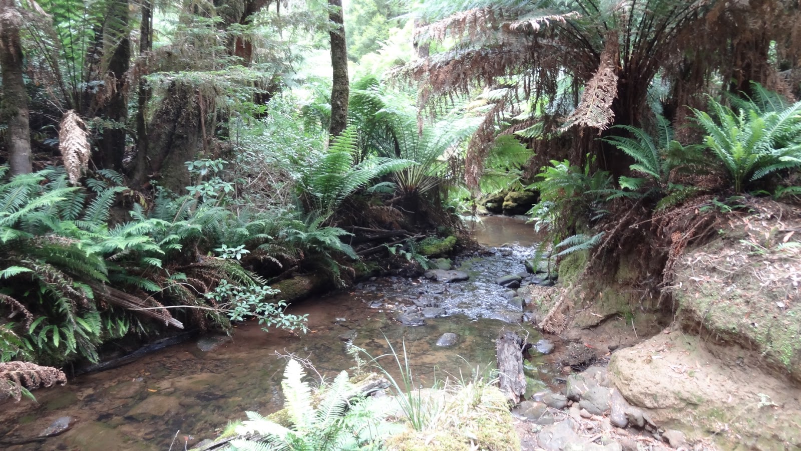
After about 20 minutes of steadily heading down into the bush you'll maybe hear the waterfall and reach a fern lined creek. If you've come down in the right area the waterfall should sound to your right.
 |
| Staircase Falls creek track. |
Following the pink ribbons it's a matter of making your own way down onto the creek bed, as there wasn't any specific obvious path.
Head right along the creek bank for a few minutes to reach Staircase Falls. The Falls are situated in a nice small canyon surrounded by tree ferns.
 |
| Staircase Falls. |
Even though it was the end of the summer, there was a bit of water coming down the falls.
 |
| Staircase Falls. |
After the falls we turn back along the creek bypassing our "entry track" and within 5 mins cross over Cumberland River to the other "western" river bank.
These surrounding areas are basically the source of the Cumberland River. |
| Cumberland River. |
The track then climbs slightly uphill parallel to the river for a few minutes and T intersections with Ricketts Track (this should appear on the right and leads up to Wye River Rd).
We turn left and head back downhill to Cumberland River.  |
| Track to Allambee Beek Falls. |
Getting closer to the river the track diverts left along the river bank before reaching Allambee Beek Falls.
 |
| Allambee Beek Falls. |
Theres more space here than Staircase Falls with some boulders to take a rest on/food break next to the falls.
I didn't try to find the Black Velvet falls as there didn't appear to be a way to it along the creek bed, most likely easier to find a way closer to Curtis Rd.
I headed further along Cumberland River for 5 minutes, crossed over and then looked for an exit point left of the river to head back up to Curtis Rd.
There may be pink ribbon markers here to follow, but if you head left uphill and stay straight sooner or later you should break out onto Curtis Rd within 30 mins.
 |
| Cumberland River |
Walking back uphill to find Curtis Rd from here is the trickiest part of the hike. Unless you have a GPS, then best advice is to retrace your steps. After about 30 minutes of track finding up through the forest you will be back at the original entry point with Curtis Rd. The times I give for this are pretty conservative as I was doing a bit of re-taping of trees where needed.
Once you are back on Curtis Rd, you can either finish the hike and head back to Mt Sabine Rd or continue on down along Curtis Rd to do the Galliebarinda Falls hike.
It is a 30 min walk further on along Curtis Rd. The Galliebarinda Falls track is located where the Cumberland River crosses the road.
The river at the time of the hike was a very shallow small creek and could be driven thru with a 2wd car.
There was a small clearing here on the right that could be used for an overnight camp, although your right next to the track.
A track on the furthest side of the river on the left leads to Galliebarinda Falls. (~45 min return walk)