Showing posts with label Otways NP. Show all posts

Sunday, January 20, 2013

Currawong Falls - Otway NP - VIC

Walk:  Currawong Falls


Distance/Rated Duration/Type:  Hike 12km / 3.5 Hrs / Loop

Terrain/Rating:  Steady walk up through forest past the waterfall. Short distance but moderate walk back up.

Start / Finish Time:  9:00am  / 12:30am

Start / Finish Location:  Distillery Creek  Picnic Area, Aireys Inlet

Trip Summary: 
From the Lower Picnic area a  steady slightly uphill walk crossing a dirt track and creek before passing by the side of the falls  Continuing on past the falls the track loops down through a swamp and back towards the carpark.. There is no way of getting to the bottom of these falls from the track.

How to get there:
Take Bambra Road from Aireys Inlet for 10 minutes and turn left at the Distillery Creek Picnic Area sign. A few hundred meters up the dirt road turn right into the lower carpark.  The walking track starts at the end of the carpark. There are toilets in the other carpark on the other side of the road. There are a couple of picnic tables at both carparks.
 
Trip Detail:

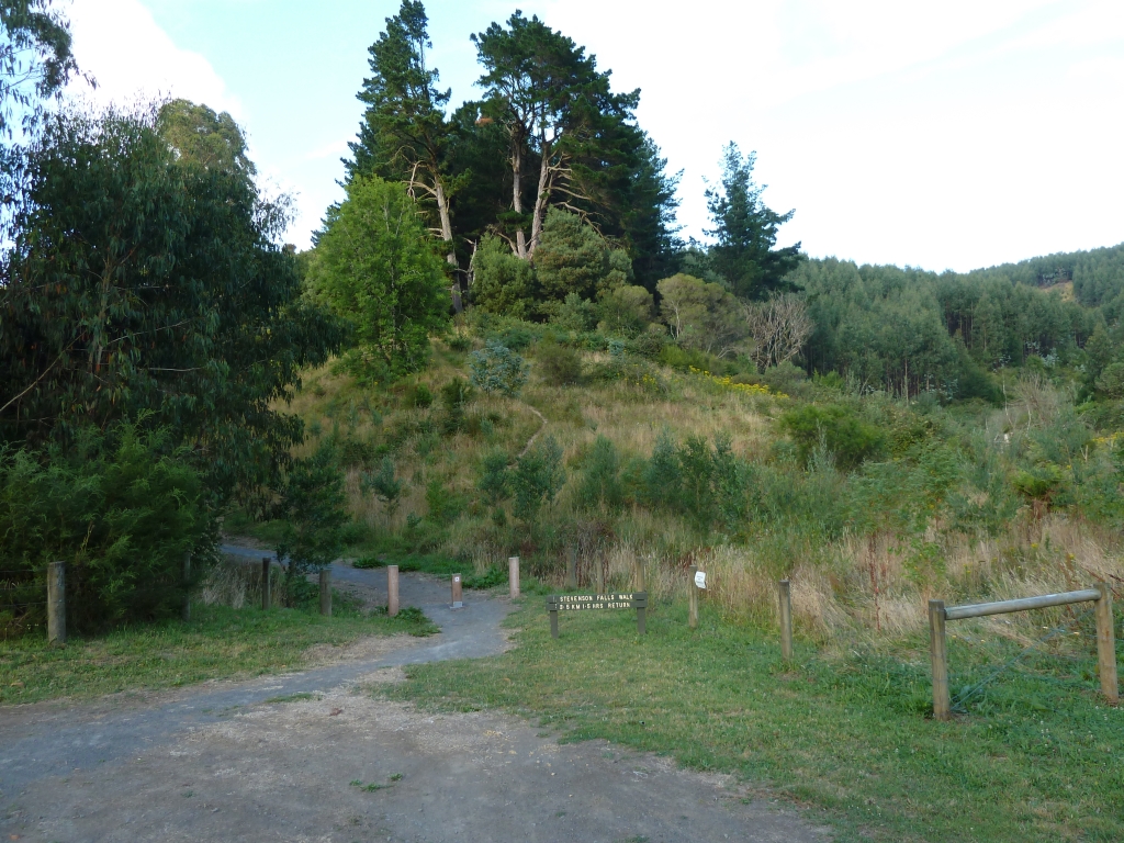
Entrance to lower carpark.


From the carpark head to the end of the road to start the walk. 


Theres a small pond and a few picnic tables here.

Heading up along the track you get some nice view of the Aireys Inlet coastline.


About 1 hour into the hike you cross Love track and the track reaches its highest and most open point.

From here you have views of the surrounding forest before heading down into more lush forest and the falls. Due to the dry summer there was no water at all in the falls.


The track follows the creek for a while before heading through a lush fern gully and then the Melaleuca Swamp.

The track then loops to the right and parallels the No2 road back towards the Picnic Area.
 
 
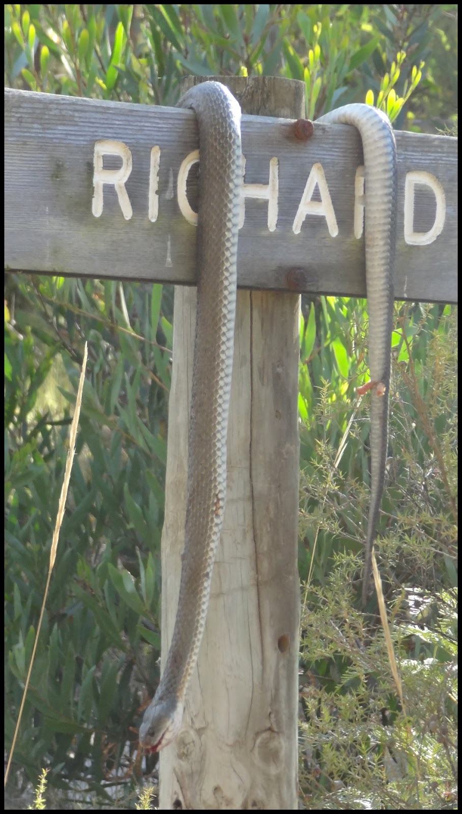
With some luck you might view some of the wildlife in the area.  But hopefully not one of these guys.
 
No 2 track.
Overall a nice easy hike not really worth the drive unless its in addition to other hikes in the area.
Would work as a side trip to the Moggs Creek, Aireys Inlet, Bambra Road loop walk.
 

Sunday, February 6, 2011

Sabine Falls - Otways NP - VIC

Walk:  Sabine Falls


Distance/Rated Duration/Type:  Hike 4km / 1 Hr / Return

Terrain/Rating:  Steady walk down through forest to viewing platform. Short distance but moderate walk back up.

Start / Finish Time:  9:50am  / 10:50am

Start / Finish Location:  Sabine Falls Picnic Area.

Trip Summary: 
Short easy slight downhill walk to view waterfall across the valley.
From the Picnic area a  steady walk crossing a couple of streams to the falls viewing platform with views of the falls across the valley. There is no way of getting to the top or bottom of these falls from the track.

How to get there:
Take Sunnyside Road just south of Barramunga. Turn right after about 5 minutes onto the dirt road and the Sabine Picnic area carpark is about 5 minutes down the by the side of the road on the right.

Trip Detail:

Sabine Falls Picnic Area carpark.
There are no toilets at the picnic area (2011), just a couple of picnic tables under trees.

Sabine Falls Picnic Area.
You are initially greeted by a "Slippery Rocks" warning sign at the start of the track as it heads off into the forest.


The majority of the track is dirt, there are rocks across 2 streams which may be tricky if there has been recent rainfall. Most steps are compacted earth although there are a few rock steps that are fine in normal weather conditions.
Heading down the track you walk through a nice mix of forest and ferns.


After 15 minutes or so you reach the W R Henry Mill site.
There are signs of mill work in the area with a trench you walk across.


Continuing along the track you cross over 2 small streams.


Another 10 minutes or so of walking along the track and down steps you reach the lookout with views of Sabine Falls in the distance.


A nice walk with unspectacular view of the waterfall in the distance.
The heart gets a good workout as you retrace your steps slightly uphill back up to the Picnic ground.

Stevenson Falls - Otways NP - VIC

Walk:  Stevenson Falls


Distance/Type:  Hike 6km / Return

Terrain/Rating:  Pretty much flat along the river. Very Easy.

Start / Finish Time:  8:10am  / 9:00am

Start / Finish Location:  Stevenson Falls Campgrounds.

Trip Summary: 
From the Campground a very easy 40min return walk following the river to the waterfall.

Trip Details:
There are 2 ways to do this walk. If you are camping, walk to the far end of the campgrounds to start the track.


For a day visitor, bypass the campground by keeping left after crossing the river and drive to the the Day visit car park.  This will save 15 minutes off the walk without missing any worthwhile views.  The walk described here is from the campground.


The track follows the creek for a few hundred metres before a short diversion up a tree fern gully which is the nicest part of this section of the walk.
After about 10 minutes you join the road to the carpark and the first obvious signs of plantation work in the area.


Bypass the bulldozer track and follow the path next to the road for a few minutes. The path diverts away from the road through a small cluster of Pine trees before rejoining at the day carpark.


A lovely entrance to the track via the bridge across the river greets you at the carpark.

Through the trees on the other side of the river the track opens up into a grassed area then thru some gum trees before tracking the river..


After about 5 minutes you reach the lookout platform at the falls.


There are plenty of ponds along the way and a rather deep pond at the base of the falls.


Either retrace the track back to the campgrounds or you can follow the dirt road which only takes an extra 5 minutes.

For those who are adventurous there is a faint track midway back along the track that skirts up to the top of the falls which allows you to walk further upstream along the river.

Saturday, February 5, 2011

Campsites - Stevenson Falls - Otways NP - VIC

Campsite - Stevenson Falls - Otways NP:


How to Get there:
Located in Barramunga off the Forest-Apollo Bay Rd, signposts of the camping ground appear 300m before the turnoff.  Drive down  Upper Gelibrand Rd (dirt road) for about 5-10 mins to reach the campground.


Crossing the river you are directed by sign to the right for the campsite or left to head over another bridge to the Falls Daylight carpark which is another minute or 2 along the road.

Campsite:
Stevenson Falls is a lovely campsite. Plenty of well grassed areas to either pitch a tent or park a campervan.


On entering the campground there is an open camping area for groups on the left.
A nice elevated dual pit toilet sits in the middle of the grounds and both were in good condition.


If you head down the right track there are designated campsites amongst the pine trees.


The sites are fenced and are separated by the Pine Trees. Theres is plenty of space to put multiple tents on each site.


The Gelibrand River runs through the whole area and is accessible from a few locations. Didnt look deep enough for a dip but there are some nice ponds nearer the waterfall.


You can walk to the falls from the campsite by going to the end of the campgrounds but the scenery isn't particularly nice on that part of the walk with obvious views of logging from plantation work in the surrounding hills.


Its a pity that the logging could not be kept to behind the ridge as those views are the only downside to this free campground.

Wednesday, February 1, 2006

Kalimina Falls - Otways - VIC

Walk:  Upper/Lower Kalimna Falls & Castle Rock walk.

Lower Kalimna Falls.

Distance/Type:   8km / ReturnTrip

Terrain/Rating: Easy walk along slightly hilly track for 3 to 4 hours.

Start / Finish Time: 10am / 1pm

Start / Finish Location:  Sheoak Picnic Ground carpark.

Trip Summary:
Nice walk through rainforest to Upper then Lower Falls then a sidetrip to Castle Rock Lookout.

Trip Details:
From the carpark continue head off past the information stand and over the small footbridge.


The walk follows the beautiful fern laden Kalimna Creek.


After crossing a bridge 30 minutes further along you come to a fork in the track path, the right track goes to the Lower Falls, the right track which we first take goes to the Upper Falls.


After about 1.3km you reach the boardwalk and viewing platform for the Kalimna Upper Falls.

Upper Kalimna Falls viewing platform.
Upper Kalimna Falls.
Heading back to the fork in the track we check out the Lower Falls.

Lower Kalimna Falls.
Its possible to walk into the cave behind the falls, a nice spot for a lunchbreak.


View from behind Lower Kalimna Falls.
Heading back to the carpark we take the Castle Rock track at the intersection.


This takes us on a 20min return walk down a zig zag track to the side of the Cumberland River valley.

Castle Rock Lookout track.
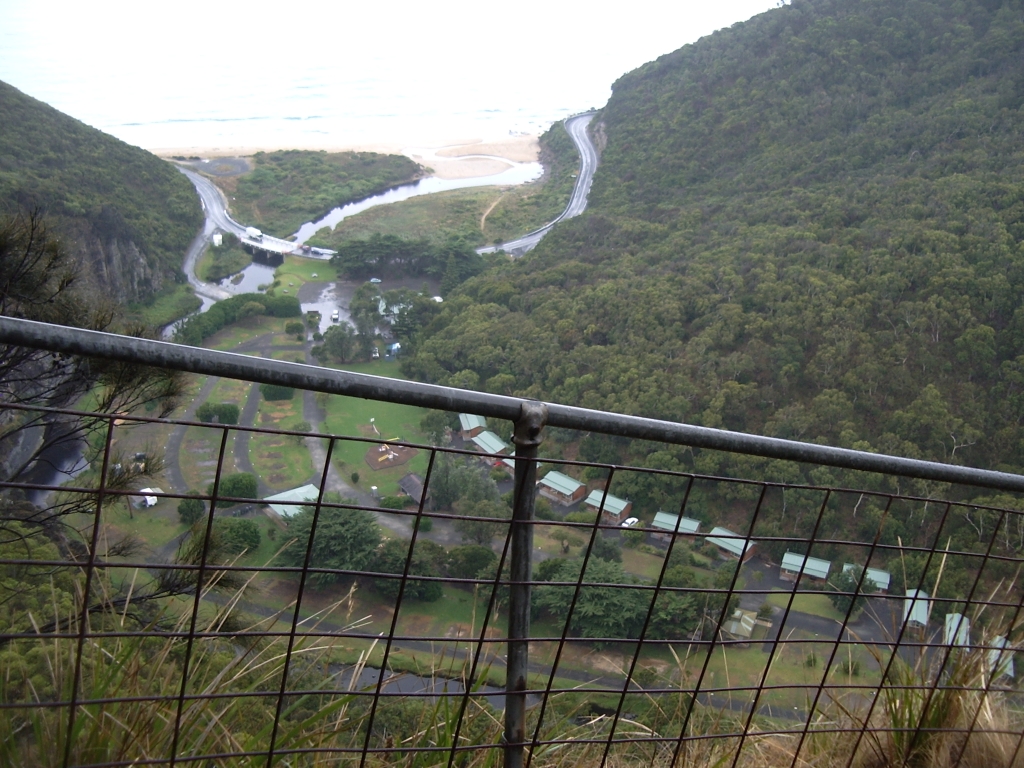
There is nice views of the ocean and Cumberland River camping area from the lookout.
Unfortunately I had an overcast day on this walk.

View from Castle Rock Lookout.
30 minute return to the carpark from here.