Saturday, January 26, 2013

Toorongo Falls - Baw Baw NP - VIC

Walk:  Toorongo Falls loop.


Distance/Type:   2.2km / Round Trip

Terrain/Rating: Slight incline along the Toorongo River for 30 mins to the first falls then works its way back down via track loop. Easy.

Start / Finish Time:  3pm  / 4pm (Conservative Times)

Start / Finish Location:  Tooronga Falls carpark.

Trip Summary: 
This would be a nice walk to take the family. About 1 to 1.5 hour loop walk with 2 waterfalls and a nice river saddling the tracks for most of it. There are quite a lot of areas where you can walk to the waters edge and I was lucky enough to encounter some wildlife and nice berries on this trip. The only hassle is its quite a drive to get there being about 30 mins short of the Mt Baw Baw summit along the Mt. Baw Baw tourist road.  Theres a 15 minute drive up the Tooronga Valley dirt road that leads you past a free camping area (seems to be be popular with dirtbikes) before reaching the Tooronga Falls carpark. 

Trip Details:
From the carpark head up the main track to the right of the toilet block.


The track follows the Toorongo River for a few hundred metres before you reach a bridge that crosses over it.
.


50 meters after the bridge you come to the track loop intersection sign with Toorongo Falls to the right and the direct walk to Ampitheatre Falls to the left. 


The sign directs everyone to do a counter-clockwise walk around the loop to take in both falls.


The track continues to follow the river along a beautiful fern gullied path.


Luckily on my trip I came across a lyrebird that was chirping away with a cacophony of sounds.
To listen to some of the sounds from this amazing bird go here.


After another few hundred metres as you get closer to the waterfall, moss laden boulders start to line the path.

 
At about 30 minutes into the walk you reach the Toorongo Falls and its viewing platform.

Toorongo Falls viewing platform.

There was a lot of water in these falls which I thought was surprising seeing as we had not had any significant rain for a few months and it was the middle of summer.

Toorongo Falls.

From here you continue along the other track that takes about 10 mins to get to the Ampitheatre Falls.

Ampitheatre Falls.

There is a metal caged lookout that hangs out over the river in front of the falls.

Ampitheatre Falls viewing platform.


Ampitheatre Falls.

From here the track follows the river and heads back down to join up at the other leg at the loop intersection after another 15 mins or so. Retrace your steps to the carpark or head along the vehicle track directly straight off the bridge.  There is a picnic area at the carpark off this track which has nice views of the area.

Toorongo Falls picnic area.

The toilet block at the carpark has flush toilets. The toilet block at the camping area 500m up the road looked most likely to be pit type.


Toorongo Falls camping area.
 
Please leave a comment below :)


Sunday, January 20, 2013

Currawong Falls - Otway NP - VIC

Walk:  Currawong Falls


Distance/Rated Duration/Type:  Hike 12km / 3.5 Hrs / Loop

Terrain/Rating:  Steady walk up through forest past the waterfall. Short distance but moderate walk back up.

Start / Finish Time:  9:00am  / 12:30am

Start / Finish Location:  Distillery Creek  Picnic Area, Aireys Inlet

Trip Summary: 
From the Lower Picnic area a  steady slightly uphill walk crossing a dirt track and creek before passing by the side of the falls  Continuing on past the falls the track loops down through a swamp and back towards the carpark.. There is no way of getting to the bottom of these falls from the track.

How to get there:
Take Bambra Road from Aireys Inlet for 10 minutes and turn left at the Distillery Creek Picnic Area sign. A few hundred meters up the dirt road turn right into the lower carpark.  The walking track starts at the end of the carpark. There are toilets in the other carpark on the other side of the road. There are a couple of picnic tables at both carparks.
 
Trip Detail:

Entrance to lower carpark.


From the carpark head to the end of the road to start the walk. 


Theres a small pond and a few picnic tables here.

Heading up along the track you get some nice view of the Aireys Inlet coastline.


About 1 hour into the hike you cross Love track and the track reaches its highest and most open point.

From here you have views of the surrounding forest before heading down into more lush forest and the falls. Due to the dry summer there was no water at all in the falls.


The track follows the creek for a while before heading through a lush fern gully and then the Melaleuca Swamp.

The track then loops to the right and parallels the No2 road back towards the Picnic Area.
 
 
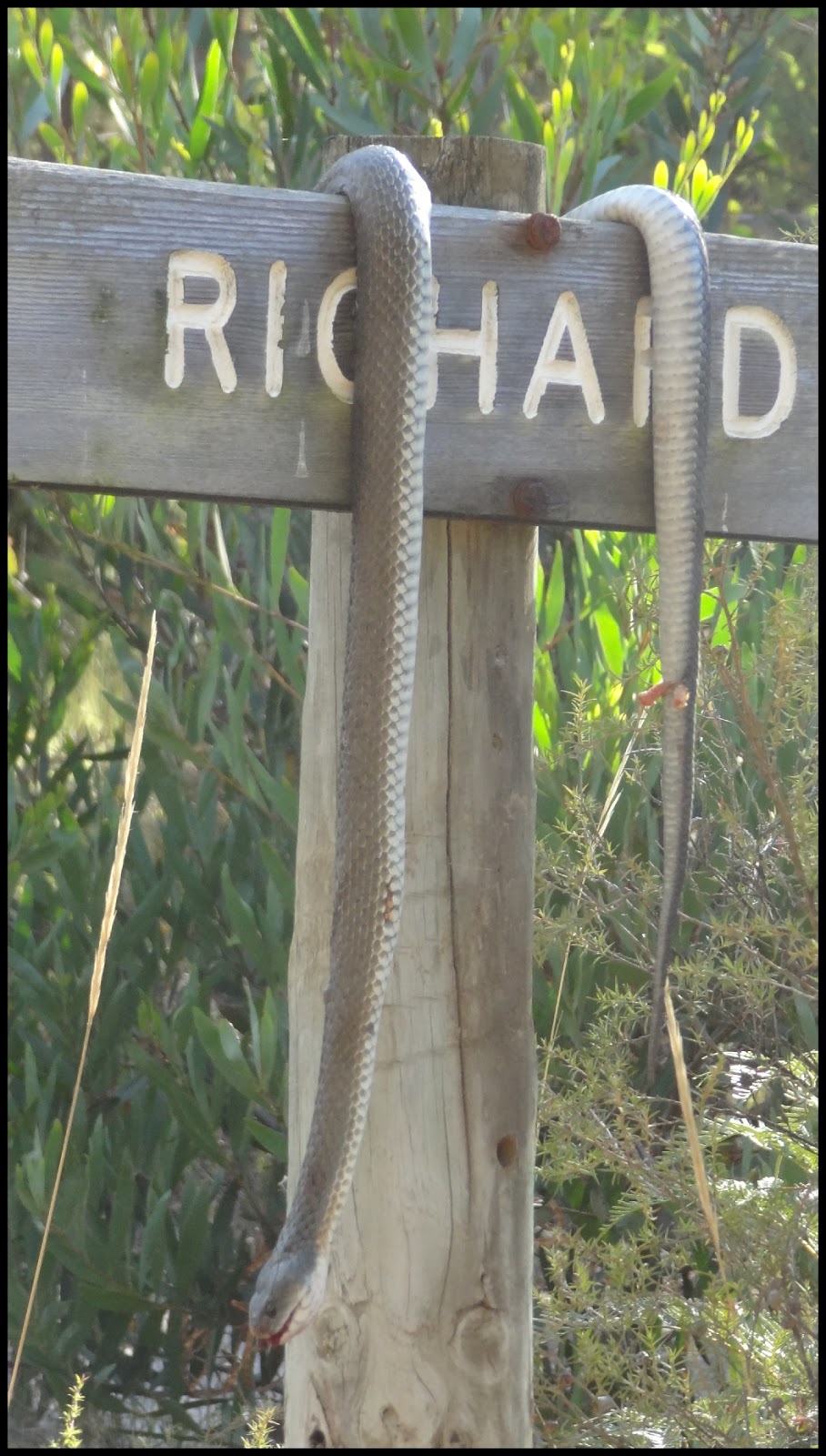
With some luck you might view some of the wildlife in the area.  But hopefully not one of these guys.
 
No 2 track.
Overall a nice easy hike not really worth the drive unless its in addition to other hikes in the area.
Would work as a side trip to the Moggs Creek, Aireys Inlet, Bambra Road loop walk.
 

Tuesday, January 1, 2013

Waterfalls List

Waterfall List

VICTORIA:
Allambee Beek Falls (Otway NP)
Ampitheatre Falls (Mt Baw Baw NP)
Beauchamp Falls (Otway NP)
Carisbrook Falls (Otway NP)
Conglomerate Falls (Alpine NP)
Cora Lynn Falls (Otway NP)
Cyathea Falls (Tarra Bulga NP)
Dights Falls (Melbourne)
Erskine Falls (Lorne)
Hopetoun Falls (Otway NP)
Lower Kalimina Falls (Otway NP)
MacKenzie Falls (Grampians)
Marriners Falls (Apollo Bay)
Phantom Falls (Otway NP)
Pieman Falls (Alpine NP)
Silverband Falls (Grampians)
Snobs Creek Falls (Eildon)
Staircase Falls (Otway NP)
Steavenson Falls (Marysville)
Stevenson Falls (Otway NP)
Straw Falls (Lorne)
Tarra Falls (Tarra Bulga NP)
Toorongo Falls (Mt Baw Baw NP)
Triplet Falls (Otway NP)
Upper Kalimna Falls (Otway NP)

NEW SOUTH WALES:
Wentworth Falls (Blue Mtns NP)
Katoomba Falls (Blue Mtns NP)
Bridal Veil Falls (Blue Mtns NP)

TASMANIA:
Hogarth Falls (Strahan)
Liffey Falls (Deloraine)
Montezuma Falls (Rosebery)
Nelson Falls
Queenstown Falls (Queenstown)

QUEENSLAND:
Bahnamboola Falls (Lamington NP)
Coomera Falls (Lamington NP)
Elabana Falls (Lamington NP)
Neerigomindalala Falls (Lamington NP)
Yarrabilgong Falls (Lamington NP)

NZ:
Bridal Veil Falls (Routeburn Trk)
Earland Falls (Routeburn Trk)
Giant Gate Falls (Milford Trk)
Hidden Falls (Hollyford Trk)
Humboldt Falls (Hollyford Trk)
Iris Burn Falls (Kepler Trk)
Mackay Falls (Milford Trk)
Routeburn Falls (Routeburn Trk)
Sutherland Falls (Milford Trk)

Friday, August 3, 2012

Tarra Valley Loop Track - Tarra Bulga NP - VIC

Walk:  Tarra Valley Loop Track


Distance/Type: Hike 23km / Loop

Terrain/Rating: Undulating terrain through plantation and National Park Forest following walking tracks, disused 4wd tracks and some road.  Medium rating due to distance and some 30+ min uphill sections.  This is a solid full days hike.

Start / Finish Time:  9:30am / 4:00pm (6.5 Hrs)

Start / Finish Location: Tarra Bulga Visitor Centre carpark.

Map: 


Trip Summary:
The Latrobe Valley has had to deal with some major natural disasters in the last few years ranging from bushfires to floods.  Tarra Bulga National Park is one of a number of parks in the area that has felt the full brunt of it. It's only been through the great work from a lot of volunteers that a number of walks have been created or reopened in the last year or so that we can now experience this diverse area again. 

At the time I did this walk part of the Tarra Valley Road was closed due to a mudslide caused by flooding a few weeks earlier.
To get on the Tarra Valley Loop Track, walk from the carpark, along Bulga Park Rd then divert through the forest via Old Balook Road for 30 mins before arriving back on Bulga Park Rd about 2km further down.
We cross over and along the road before connecting up with Diaper Track which takes us through a pine plantation and then National Park forest. An hour on Diaper Track we view two small waterfalls which flow across the track before heading down onto Tarra Valley Road and then into the Picnic Area. A pretty loop track at the Picnic Area takes us to the main waterfall. We then head up into the hills via a bushbash track and along forest ridge for 5.3km before heading back down onto the road further north. From here we divert off the road, via some disused 4wd and management tracks before heading back up hill through a bushfire affected area and back down into the Visitor Centre.

Trip Details:
At the carpark you will notice a Great Strzlecki walking track marker just to the right of the Visitor Centre.  Pass this marker and walk through the gap in the trees towards the road. (9:30AM)
(Click on Images to enlarge)
Tarra Bulga Visitor Centre.
Head left from here and then left up Bulga Park Road which has the Teahouse/Cafe on the far corner.
After about 200m take the left fork up Old Yarram Balook Road (dirt road). Markers indicate the way.

Old Yarram Balook Road to left.
Along this dirt road are the historic sites of  Riggs Sawmill and Old Balook Primary School. 
Up the hill divert right and take the track through the forest. This is still apparently Old Yarram Balook Road even though the left track looks more like it would be the main track.
After 1km, Forest Track will appear on the left (this is a short loop track back to the Visitor Centre). Bypass Forest Trk and continue straight on for another 500m, also bypassing Wild Cherry Track on the left.  We end up back down on the bitumen of Bulga Park Road.
Once at the road you'll notice a dirt road 100m to your left on the opposite side of the road, this is the continuation of Old Yarram Balook Road. So head left along Bulga Park Road and then right up the Old Yarram Balook dirt road. The road will lead up and left around a corner for about 400m before reaching the intersection with Diaper Track. Turn right onto Diaper Track and follow the markers to the right through the Pine Plantation. (10AM)

Pine Plantation along Diaper Track.
After 4km of plantation forest you will reach the intersection with the Tarra Valley Link Track. (10:45AM) 
At the time of this hike there was a distinct track heading left at the intersection and also a bush-bashed track with hidden Tarra Valley Link Track sign covered heading its way straight ahead through the forest and had fluro pink ties leading the way. The overgrown track is the Tarra Valley Link Track which leads down to Tarra Valley Road and some local caravan parks. The left defined track though is strange as nothing is marked in the current map about it.  Our Tarra Valley hike uses the Diaper Track which is well signed and a right turn at this intersection.
Heading right and 400m past the intersection we reach the first of 2 small waterfalls

Coming up to first waterfall along Diaper Track.
Both of them are right next to the track and flow across it, but are easy to walk across.

First small waterfall.
Another 700m down the track is the 2nd small waterfall.

Second small waterfall.
Continuing on for another 400m we diverge down onto the bitumen of Tarra Valley Road. 

(This location is where you could take a side trip on this hike. Tarra Falls is about 600m left back down the road and would be a good side trip rather than doing some of the "official" track later on. I didn't look at Tarra Falls on this trip as I wasn't sure how much time would be needed to complete the walk.)
Continuing right, up Tarra Valley Road, you cross over a creek.

Creek along Tarra Valley Road.
 Continue up across the bridge and along Tarra Valley Road for 600m and you reach the picturesque Tarra Valley Picnic Area. (11:15AM)

Tarra Valley Picnic Area.
 There are two shelters with tables and benches and a well equipped toilet block with running water from the creek. The archway leads down to a 1km loop walk to Cyathea Falls from here.

Tarra Valley loop walk to Cyathea Falls.
 Just down the walkway there are picnic tables and seats along the Tree Fern lined creek allowing for over 20 people. This is a lovely area to have your lunch break.

Tarra Valley Picnic Area.
 The walk to falls is a loop (East Walk then back along West Walk) and takes about 20-30mins.

Tarra Valley Picnic Area loop walk.
  Well worth the effort as it is the highlight of the walk. At the time of this hike the Falls were closed as a viewing platform was being built for the waterfall, but I snuck in to have a look.

Cyathea Falls.
Once back at the Picnic Area, from here, there are 2 options to walk the next stage to the Ridge Rd intersection.
 
Fastest way back is 8km along the road.


For this hike I did the 5.3km hike, bushbashing up the Unamed Track, then along a ridge track and down a hill to reach the same Tarra Valley and Grand Ridge Road intersection as if you just walked 2.8km further north up along the road.
Quite frankly if I was to do this walk again I would bypass this next section as there really is nothing of note to view for putting in the effort.  Here is the description of that section.

The next section of the official walk is reached a further 100m up the road.  On the left near the slippery when wet road sign is a small set of stairs that leads up onto the Unamed Track. (12:00PM)

Unnamed Trk just past the post.

Its pretty much a bush bashed track that starts working its way above and back towards the picnic ground before diverting away and ascends steeply into the forest. 

Steps to the Unnamed Track.

There is no real pathway as such, but the markers are well spaced where you need them as you walk your way up the hill through the forest over all sorts of debris for nearly 2km. This took me about 45 mins while clearing some of the track and taking breaks. It was the hardest part of the walk due to the climb and clearing debris.  (12:45PM)

Markers were pretty well placed on the Unamed Track.
Once up the top you reach a Management Track. Plenty of debris was covering this track as well but it is an obvious vehicle track. Even though you are now up pretty high there aren't any views of the surroundings through the forest canopy. After 1km along this track you join up with Butlers Track although its not clear on the map where one track starts and the other finishes. Most of the markers are pretty good but some could be better pointed to the direction you should be going in this area.


The walk is fairly easygoing for another 2km along Butlers Track.  You need to be on the lookout for the faint track back down to the road on the right. It would have quite easy to miss but for the reverse side of a marker along a straight section of Butlers Track (a marker obvious for hikers coming the other way).  

Track in the gap just to right of bush

Maybe there had been some recent storm damage but there were no obvious signs for this exit track as there were plenty of trees covering its entrance and only some fluro pink taping behind the trees caught my attention to it. After noticing an official track marker a bit further down the slope I was happy to continue on down the "track". 

Track marker


For this reason it would be useful to have a GPS with you on this hike.
This was basically the same type of non-descript bushbash track we took uphill earlier but this time thankfully downhill and only 500m long before reaching the intersection of Tarra Valley and Grand Ridge Roads.  At the time of this hike, the Tarra Valley Road was barricaded off here due a landslide further south. (1:30PM)

Once again, at this intersection and depending on time, you can shortcut the tracks and just walk along the road back to the Visitor Centre carpark.  From here Grand Ridge Road back to the carpark is 4.2km so approx 1 hour walking.

Grand Ridge Rd intersection

Otherwise, continuing the Tarra Valley Loop track through, from the intersection we head across the road and follow the markers on Mountain Hickory Track.
The large signs show distances of references for those on the Great Strzlecki track. You want to head along the Mt Tassie route for now.

Great Strzlecki track signs on Mountain Hickory Track.

Continue on the Mountain Hickory Track for 1km bypassing the Traralgon Creek Reserve track on the left. After another 1.8km you reach the 4 way track intersection with Goomballa Road. (2:20PM)

Mountain Hickory Track & Goomballa Road intersection.

We go straight ahead and join onto Goomballa Road, the Great Stzelecki track signs now mention Balook.
(As an option heading right on this intersection would take us back onto Grand Ridge Road at the Pattison Rest picnic area and is a shortcut back to the Visitor Centre car park along the road.)

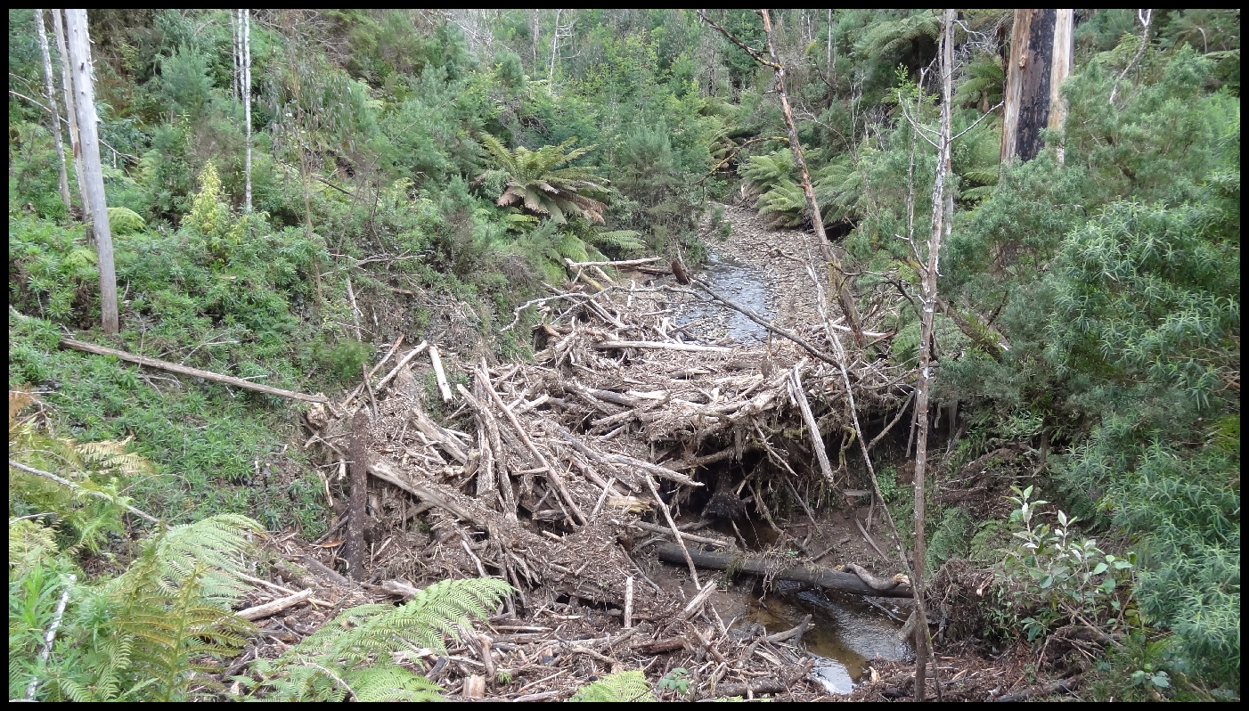
Follow the winding Goomballa Road for 2.1km.  It was pretty flat terrain and muddy in spots at the time of this walk . There was a mudslide across the road from a feeder creek into the Little Traralgon Creek which required some tricky footwork so you didn't end up stuck in knee deep mud.

Mudslide on Goomballa Road.
As you walk along Goomballa Road you start to notice the fire affected forest in the surrounding hillside and realise from the map you have to walk down to the creek valley and then up through that forest to continue the trail. Once we reach another 4 way track intersection we need to do a sharp right hairpin turn down to the creek valley along West Face Track. (2:35PM)

View of Little Traralgon Creek from West Face Track.
We cross over Little Traralgon creek and then start the climb up the hill. After 1.7km you divert right  off the track onto a steeper dirt walking path. (2:55PM) From here it all gets a little bit ugly as you cross a crushed rock track further up the hill before it opens out into the bushfire affected area with slashed trees and muddy bulldozer tracks and no obvious markers of any sort.

Fire devastated forest.
Walking along the bulldozer trail for 10 minutes you head out for some nice views of surrounded forest before heading back inland up the hill. Track signs start to reappear further up the road. The "motorcycle width" track on the map is now a bulldozer width track, a Balook sign which we follow points the way to the left.  

Walking up the steep track for 10 minutes you end up on Drysdale Road.
Although the map mentions Morningside Grange Homestead and a Picnic Area, I noticed neither of these along the road. (Burnt down in 2009 bushfire?)

Drysdale Road.

Once out of the deforested area Drysdale Rd starts to become treelined road for about 15 minutes. Telecom Track appears on the right, appropriately lined with Telecom warning signs. (3:40PM)

Telecom Track.

Head along the lush fern laden Telecom track which straddles Grand Ridge Road for the last 100m before joining down onto it at the intersection with the Bulga Park Road. You can either follow the Track marker sign on the left through the forest back to the Visitor Centre carpark or take the road. (3:55PM)


All in all you feel like you've done a solid full days hike after this at the end of the day.

Try and grab a bite to eat at the Tarra Bulga Guesthouse and CafĂ© which is just across the road from the car park, or better still stay there or the local caravan park for a weekend and take in some of the other hikes in the area.

Area Links:


Please leave a comment below. :)