Saturday, January 22, 2011

Howitt Trk - Alpine NP - VIC

Walk:  The Mt. Howitt Walk

The Crosscut Saw


Distance/Type:  Hike 12km / Return

Terrain/Rating:  Undulating terrain followed by a slightly uphill ridge track. Medium.

Start / Finish Time:  11:40am / 2:40pm  (3 Hrs)

Start / Finish Location:  Howitt Trk Carpark.

Trip Summary: 
Walk from the carpark, along a disused 4wd track for about 1 hour before reaching Vallejo Gantner Hut/Macalister Springs . From the Springs the track works its way slightly uphill along a ridge to the AAWT. Follow the AAWT track left over Howitts Plain up to Mt Howitt..
Head back the same way to the carpark.

Trip Details:
There are many ways to access Mt Howitt but via Howitt Rd is definitely the easiest.
The Mt Howitt carpark is a further 20 minutes along Howitt Rd from the Bryce Gorge carpark. 
The carpark has picnic tables and a pit toilet and plenty of flat area to camp.
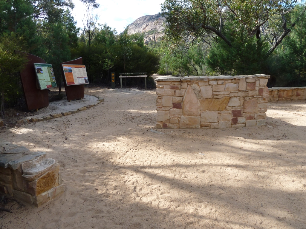
The track to Mt Howitt starts through the gap in the fence. 

Howitt Track start.

As with most walks in the Alpine National Park there is the obligatory intentions book to sign at the start.


The first half hour of the walk is typical alpine surroundings for the area, going through a few cycles of snowgum forests and plains. The path is easy to follow.


About 4km (50 mins) in, reaching a fork in the track, you can take the left branch direct route to Vallejo Gantner hut (10-15mins) or  head straight ahead & take the alternative slightly longer route. 
With this walk I've taken the longer (20-25min) scenic route which bypasses the hut and joins the track about 100m past the hut at Macalister Springs.

Longer scenic alternative track to the right.

The bypass track is rather faint at times.  If you lose the track try to retrace your steps or if you reach the gorge edge just head left along it.  Within 20-25 mins you will rejoin the main track as it narrows its way back onto the main track further on at Macalister Springs.  (See Map below)

Alternative camping area with views of Crosscut Saw.

Along this track there is a pretty non-official campsite with nice views of the Crosscut Saw and beyond.
It is only 5-10 mins to walk to the hut, toilet and water source from the springs if required, from here.

Heading back down to the main track at Macalister Springs.

The bypass track joins the main track at Macalister Springs which is just down from the hut and has a nice campfire area. Always treat the water from these springs.

Macalister Springs.

Once back on the main track at the springs turn right and head along the ridge towards the Australian Alps Walking Track (AAWT). This is a well-treed slightly uphill narrow ridge track and takes about 15 mins to reach the AAWT junction, which has a marker.


Track along the ridge.

This is a lovely part of the walk with spectacular views of Crosscut Saw and Mt Speculation on your right.

View of Crosscut Saw.

At the AAWT junction we head left and walk across the Howitt Plains for 10 mins before heading up the slope to Mt Howitt. 
In early spring there may still be remnants of snow on the eastern edge of the plains.

On the AAWT heading up to Mt Howitt.

I've hiked twice to Mt. Howitt & for some reason I've been swamped with blowflies each time.
Both times have been warmish weather, so I'd suggest taking insect repellant with you have low insect tolerance.

View from Mt. Howitt.

The view from Mt. Howitt is spectacular with views of Crosscut Saw and Mt Speculation along the AAWT track to the East.   Head back the same way you came to Macalister Springs.
Continuing on along the main track you reach the majestic Vallejo Gantner Hut.


Vallejo Gantner Hut.

There is a fireplace inside and it has multiple levels of  space to sleep if needed in emergencies.
There is also plenty of flat area for tenting around the hut.


A special mention to the nearby toilets sitting on the southern bank here. They have a perspex window and open out to views over the valley. Probably the most spectacular view you'll see sitting on a wilderness loo in Australia. 

Howitt Track toilet.

Head up the main track, back past the track junction and within a hour you are back at the car park.

Remember to sign out of the intentions book. :)

Track Map:


Mt. Howitt


Bryce Gorge Circuit - Alpine NP - VIC

Walk:  Bryce Gorge Circuit


Distance/Type:  Hike 8km / Return

Terrain/Rating:  Slight undulating terrain. Creek beds and cliffside walk. Easy.

Start / Finish Time:  9:15am  / 11:15am

Start / Finish Location:  Bryce Gorge Carpark.

Track Map:


Trip Summary: 
Nice easy 2 hour circuit walk following the creek valley to the Bryce gorge for views of Piemans and Conglomerate waterfalls.
Head up along the Conglomerate River then across plains and past Guys Hut back to the carpark.

Trip Details:
Driving up from the Wellington River campsite area the road changes to dirt just after the Wellington River bridge / Lake Tali Karng track. Heading up Tamboritha Road I thought we were going to have a overcast day ahead but as I found out 10 minutes later it was just low level morning fog.
(Click on images to enlarge)

Heading up Tamboritha Rd just after Wellington River crossing.
It took about 40 minutes to get to Arbuckle Junction.  Here you turn left and head up Howitt Road.

Arbuckle Junction.
You'll pass the Snowy Range airstrip and within 20 minutes you'll be at the Bryce Gorge carpark. It has picnic tables and a pit toilet.
As with most walks in the Alpine National Park there is the obligatory intentions book to sign at the start of the track.
Bryce Gorge Track start.
After 100 metres or so you come to the circuit intersection. You can either head left and do the walk clockwise which heads to Guys Hut first or anti-clockwise via the righthand path via to the waterfalls which is the way I chose.

Guys Hut left, Waterfalls right.
Veer right and the track takes you north along the Piemans creek valley for a few minutes before heading down and crossing Piemans creek and continuing along on the opposite bank.


Piemans Creek crossing in the distance.
The track continues along the Piemans Creek for 5 or so minutes before veering away and up as it gets closer to the gorge cliff edge.


Piemans Creek.
There are two fenced viewing platforms of the Piemans Falls.

Piemans Falls Lookout # 2
 I've read that there is supposedly another non-official viewing area further down the cliff but not being particularly fond of heights I wasn't willing to test the theory.

Piemans Falls
From the second lookout the path heads inland and upwards for a few minutes through forest before veering back to the gorge and opening up to the Gonglomerate Falls Lookout.


Conglomorate Falls.
A few minutes around from the lookout is a lovely treed area that has views of the gorge and falls and would be a nice place for lunch or to set up camp.

Lunch Spot
A few minutes further on we reach the Conglomerate River at the top of Conglomerate Falls.  Theres no real safe view of the lower falls from here as its a shear drop covered with bushes.

View of Bryce Gorge
The track now heads inland along the river for about 10 minutes.  There is some quite deep small pools right next to the track along here. 

Conglomerate River pond.
The track continues on before reaching a creek where it heads left and along its bank for 100m before crossing over a wooden plank bridge to the opposite side.
The track now heads over a plain for a few hundred meters before merging with the Wonnangatta Valley Track.  This track was signed as closed due to storm damage.
We continue on for another 5 minutes through the forest before reaching Guys Hut.
The hut is in quite good condition and during winter would be handy place to stay if caught in bad weather/snowy conditions.

Guys Hut.
Piemans creek flows right past the hut and there is a nice camping spot near the campfire area.
Its only a 10 minute walk back to the carpark (and toilet) across the valley from here. 
If you do this walk remember to sign off in the intentions book.


Friday, December 31, 2010

Hollow Mountain Track - Grampians - VIC

Walk:  Hollow Mountain


Distance/Type: Hike 2.4km / Return

Terrain/Rating:  Short Hilly and Rocky mountain climb

Start / Finish Time:  9:00am / 10:00am

Start / Finish Location:  Hollow Mountain Carpark.

Trip Detail Summary: 
Walk is uphill through bush for the intial 1km then up and along the rocky mountain outcrop to Hollow Mountain and its summit.

Trip Details:

Starting from the carpark walk for about 10 to 15 minutes before heading slightly uphill and reaching the bottom of the mountain range.

Track start.
From here you worm your way around and up with the occasional rock scramble.


The track opens up on the rocky mountain where the hollow cave is situated.


Around behind the cave to the left is a crevice which gives a view of the valley below.


You can walk around inside the cave with views.


Another 20 min walk to the top gives views for as far as the eye can see.


Mountain Top.


Working your way down the side trip to the abseiling area.
Its about a 15 minute side trip.


Abseiling area.


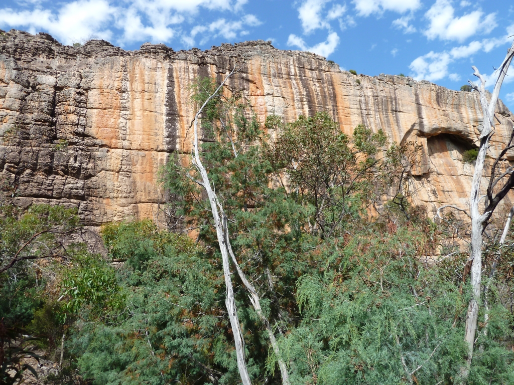
Coloured Walls.

Friday, November 5, 2010

Bay of Fires - Freycinet Peninsular - TAS

Walk:   Freycinet Peninsular


Distance/Type: Hike 33km / Return


Map:


Terrain/Rating:  

Day 1 Flat beach walk / Easy , Day 2 Hilly (600m) / Medium

Start Time:  

11am

Start / Finish Location:  

Freycinet Peninsular Carpark

Trip Detail Summary: 
Start at Freycinet Carpark, walking along Hazards Beach to camp at Cooks Hut campsite overnight, heading back to the carpark via Mt Graham the next day.

Trip Details:
For this trip we arrived in Launceston Friday evening and stayed at the nearby Treasure Island Caravan Park in Glen Dhu, which is suburb about a 5 minute drive away from the airport heading towards Launceston.

Treasure Island Caravan Park

The drive from Launceston to the Freycinet Peninsular should take no more than 2 hours.
Coles Bay is the closest town (15 mins) to the Peninsular and is a pretty location for a coffee and has a general store to pickup any late minute items.
From Coles Bay you can view the Freycinet Peninsular across the bay. 
We could see inclement weather was in store for us on this hike.


Coles Bay
Parking in Freycinet Peninsular requires a Parks Pass.
You can buy a  Parks Pass either at the carpark or from the Park Information Centre.
The Park Information Centre is on the main road from Coles Bay to the Peninsular carpark.
There are toilets here as well as at the carpark.There are no showers at the Park Center unfortunately.

We arrived at the carpark at 10:45am and were immediately greeted by a pair of pandamelons with joeys, which seem to have made the carpark their home and feeding ground.


Our hike began at 11am.
There is an intentions book at the shelter should be signed if you are doing any overnight camping.
Track Start
The initial section of the track is nicely maintained for the traffic to the popular Wineglass Bay Lookout which is about a 30 mins uphill walk.
For our trip we bypass the lookout,.

After heading a few 100m along the main track we turn right and head off down the track towards Hazards Beach.
The wide track narrows quickly to a  path which works its way around the bay.


Some nice granite boulders inland and views of the water can be seen along this section of the track.


After 30 mins or so the track heads downwards through some densely forested areas for a few hundred meters.


About an hour into the walk we arrive at the sandy shores of  Hazards Beach.
Start of Hazards Beach.
The forecast was for a cloudy drizzly day which is exactly how it panned out.
A pleasant day for walking but the lack of sun prevented the colours coming out from the water and the famous orange granite.
After walking along Hazards Beach for 30 minutes it was decided to take a lunch break on the beach while the weather was reasonable, as the weather looked more threatening further on. 

Hazards Beach.

Another 30 minutes along the sandy shores we end at the Hazards Beach campsite (which has pit toilets)
We continue on as the track works its way back into forest area but keeps close to the shoreline.

We follow Peninsula track through the forest for about 30 minutes before arriving at the shores of Cooks Beach.  There is a track junction here where the Peninsula track heads inland, over the mountains and back to Wineglass Bay. This is the return track we take tomorrow morning.

View arriving at Cooks Beach.
Start of Cooks Beach.

For our destination today, we head along the beach for a short 15 minute walk to the Cooks Beach Campsite.
Cooks Beach Campsite.

Arriving at the Cooks Beach campsite you have a few camping options.
You can camp near the beach or up to 100m inland near Cooks Hut. The campsite is well treed and pretty sheltered from the beach especially closer to the hut. 
At the time of our trip Cooks Hut was boarded up.  I have no idea whether it will be re-opened.
There are 3 water tanks that get fed off its roof with only one being available whilst we were there. There seemed to be plenty of water in the tank but we were there at the end of the winter period. so in summer best to carry in your own water.

Cooks Hut.

The campsite has a pretty beach to relax at.

Cooks Hut campsite beach.

The next morning we head back down the beach the way we came back to the Peninsula track junction to head inland. This is a longer walk than yesterdays so a earlier start was planned at 9am.


Peninsula track over Freycinet Saddle.

The weather was windy, cool and wet which we thought might make the track tricky as we had read that it could be slippery on the rocks along the way. I can only recall  2 spots along the track that I would say you had to pay attention to when walking but no real scary or dangerously slippery areas.


Peninsula track over Freycinet Saddle.

The walk through this area took 1-2 hours before you reach the Southern rend of the Wineglass Bay beach.

There is a Camping area and pit toilet here, very basic.
For our 2 day hike, we continue on along the beach.

The walk along the beach is a little over 1km.
We reached the other end of the bay /Wineglass Bay track within 20 mins.

It takes another 30min to walk up the hill to the intersection with the Wineglass Bay Lookout track.
This side track only takes 2 minutes to get to the lookout, worthwhile sidetrip on a clear day.

From the lookout intersection its 40 min mainly downhill walk back to the carpark.
If doing this hike remember to sign out of the intentions book.

Allow 2 hours to get back to the Launceston Airport.